Full text
For decades, researchers have been monitoring armed conflict around the world by analyzing news reports and collecting oral testimonies. This approach, while valuable, has its limitations. A new study suggests that a satellite's view from above might fill the gaps in our understanding of the grim realities of war.
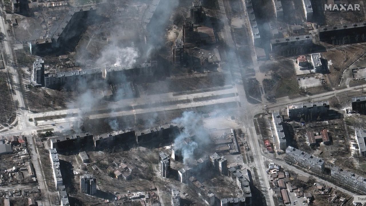
In 2017, the Myanmar Army murdered several hundred Muslim Rohingya civilians in the village of Chut Pyin near the country's western coast. Reports of the massacre in the settlement of about 2,000 reached the world through the testimonies of survivors who fled to neighboring Bangladesh. The massacre was part of a years-long campaign of brutality against the Muslim minority conducted by the Buddhist-run state. Satellite data later showed that houses in the predominantly Rohingya neighborhood were burned down by the Myanmar military during the atrocity, providing undeniable proof that the ethnic minority was targeted.
The incident is one of many demonstrating the advantage of adding views from space into conflict research, study lead author Valerie Sticher, a political science researcher at the University of Zurich in Switzerland, told Space.com.
"We have huge data sets about wars around the world going back 40 years," Sticher said. "But those datasets are based mostly on media reports. And these reports are not always available and not always reliable. Media can have biases and often focus only on certain types of violence."
For example, human reporters are more likely to focus on the numbers of people killed rather than the number of houses destroyed, she said. Satellites, on the other hand, provide a broad sweep over vast areas of land and, crucially, revisit the same location repeatedly. They can reveal patterns in conflicts and trends that could otherwise go undetected, while providing an overview of areas controlled by authoritarian regimes.
The researchers are now developing a methodology to integrate satellite observations into conflict research and create automated image analysis pipelines that would generate early warnings and alert the world to what's happening on the ground.
"Automated satellite data analysis would allow us to respond faster," said Sticher. "For example, in Myanmar, the area affected by ethnic cleansing was closed to independent journalists and investigators. Satellite data was the earliest reliable information to reach the outside world."
A SkySat Earth-observation satellite operated by the California company Planet spotted the wreckage of a failed launch out of Iran's Imam Khomeini Space Center on Aug. 29, 2019. (Image credit: Planet Labs, Inc.) Hannes Mueller, a conflict researcher at the Spanish National Research Council, said that totalitarian governments can be very good at preventing information about atrocities from reaching the world. However, they can hardly fool satellites.
"In Myanmar, for example, when the military clears villages, they frequently kill everybody in those villages," he said. "Then you don't have any eyewitnesses for you to find out what's going on. But they usually also destroy the entire village, and so the violence leaves a mark from space."
Mueller was not involved in the new study but has used satellites in his work since the conflict in Syria in the early 2010s. He lauds the new paper for trying to "plot the road" for a more systematic integration of satellite data into conflict-monitoring data sets.
"Imagine we could generate a data stack of the entire world of all housing destruction since 2020 without any gaps in it," he said. "That would be a complete breakthrough!"
But satellites, too, have their limitations, he said. Currently, spacecraft must be tasked to take images and beam them to Earth . Because of the limited download availability, they can't image every spot they fly over, meaning they usually only reveal the aftermath of catastrophic incidents. For example, the Syrian city of Homs only became the focus of satellite imaging campaigns after the Syrian military attacked it with heavy artillery to suppress pro-democracy protests.
"There are no images of Homs before it got attacked," said Mueller. "There is no archival data of the city from before. Then, after the attack, you suddenly get lots."
In the future, onboard AI image processing — which some of the commercial satellite Earth-observation companies have already rolled out — might solve the problem. Machine learning algorithms running on computers on board the satellites will be able to detect incidents of potential interest and autonomously select significant images to send to the ground.
But there are other concerns. Just as authoritarian regimes can deny access to warzones to independent journalists, governments can order Earth-observation companies to restrict access to images of specific areas. In fact, the U.S. government did just that earlier this year when it ordered American commercial Earth-observation providers like Planet Labs to stop releasing high-resolution images of the Gulf of Oman and the Strait of Hormuz amid the escalating conflict in the region. The U.S also asked Europe to delay releasing images of that region captured by the European Sentinel satellites by 24 hours.
"With that, we are back to the same biases that we have with the news reporting," Mueller said. "We need to think about infrastructure that would provide us with transparency. That would really be a revolution in conflict research."
The new study was published in the journal Nature on Sept. 9.


Comments
No comments yet — be the first to weigh in 👇
No comments yet. Be the first!